
Geospatial Technologies Laboratory
 The Geospatial Technologies Laboratory is dedicated to providing support to CKWRI researchers in the use of geospatial technologies by providing state of the art geospatial facilities, hardware, software, training, and technical support.
Development & Description
Included under the broad umbrella of geospatial technologies are Geographic Information Systems (GIS), remote sensing, Global Positioning Systems (GPS), and many other location-based technologies. These technologies have increased exponentially in importance and complexity over the past few decades within the fields of natural resource management and research. As a result, the Geospatial technologies Laboratory strives to stay ahead of the technological curve so that our researchers can enjoy a significant technological advantage in a continually technologically driven world.
When Dr. Fred Bryant was appointed as the Director of the Institute in 1996, he had a dream of developing a research program that would be used as the model and pace setter for similar research programs around the world. At the time, the Institute lacked technological sophistication and, as such, this became a focus for institutional enhancement. In 1997, the Caesar Kleberg Foundation for Wildlife Conservation donated funds to support a computer laboratory with state-of-the-art GIS capabilities. Since 1998, the Caesar Kleberg Foundation has continued their commitment to supporting the technological needs of the Institute by financing the core operational expenses of this facility. In recent years, additional funds have been allocated from research grants to expand and update the instrumentation of the laboratory.
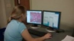
When the facility was first created in 1998, it consisted of a single laboratory that was equipped with six workstation computers, a single departmental server, and two mapping-grade GPS systems. Today, the laboratory is equipped with 8 workstations that have full geospatial technology capabilities. These workstations are equipped with GIS software (ArcGIS), remote sensing software (ERDAS; Terrset; Pix4D), spatial pattern analysis (Fragstats; CONEFOR Sensinode), ecological analysis tools (LOAS, BIOTAS), computational statistics (RStudio, Sigmaplot), and wildlife population survey software (Distance). This laboratory was designed to facilitate collaboration between users by providing an open floor plan and ample work surfaces. In addition to the workstations, the Geospatial Technologies Laboratory houses a large-format map printer as well as a tabloid color laser printer and a high-end aerial photographic film scanner.
In addition to the physical laboratory facilities, the Geospatial Technologies Laboratory is currently updating the mapping equipment that is loaned for field research. This equipment inventory consists of high-precision GPS systems, digital cameras. The laboratory also provides valuable services to the College of Agriculture, Natural Resources and Human Sciences as well as the entire TAMUK campus community. All GIS and remote sensing software license administration is handled through this laboratory as well as all software-related technical support requests. As a result, this laboratory has the only direct line of communication with GIS and remote sensing software companies on the TAMUK campus.
Geospatial Technologies Laboratory contact:
Dr. Humberto L. Perotto, Assistant Professor in Landscape Ecology